1991 Documents acknowledging acceptance as Historic Districts Hardwick, Massachusetts
Gilbertville Historic District
Hardwick Center Historic District
County: Worcester
Location: Central Massachusetts, bordered by the Town of Ware on the South, Quabbin Reservoir on the west, Petersham on the north, Barre on the northeast, and New Braintree on the east. It is about 73 miles from Boston, 30 miles from Springfield, 24 miles from Worcester and 160 miles from New York City.
Land Area: 38.40 square miles.
Elevation: (at Town Hall) approximately 880 feet above sea level.
Topographical Characteristics: From the Ware River at 600 feet above mean sea level, which forms the southeast boundary of the town, the land rises and becomes rugged as it extends to the northwest. Elevations reach 100 to 1100 feet above mean sea level. The soil is mostly either moist, somewhat stony, or rough and stony
Type of Government: Town Meeting
Established: January 10, 1739
Condensed History: It is not known whether Indians actually occupied this area, but arrow heads found in local fields show their hunting grounds were among these hills.
While the King Philip War was fought mainly in the eastern part of the colony, one conflict occurred in Winnimisset, a section which later was included in Hardwick. At the close of the King Philip War some of the Nipmuc Indians returned to this locality and their claim was recognized by the English who felt it was only just to obtain the land by purchasing it, which a group of inhabitants of Roxbury did. In 1687 eight purchasers paid a sum of twenty pounds to John Magus and other Indian sachems for the tract which was established to be twelve miles long and eight miles wide.
In 1732, after much legal entanglement, the proprietors were given legal titles to a smaller area of the land than what had been deeded to them by the Indians. One provision of the grant was that sixty families had to settle in this area within the period of five years and in 1736 the condition had been fulfilled. A petition was then sent forth asking the General Court for the Incorporation of the township. This Bill of Incorporation was approved in January 1739. The township then received the name Hardwick, in honor of Lord Hardwicke, an English nobleman.
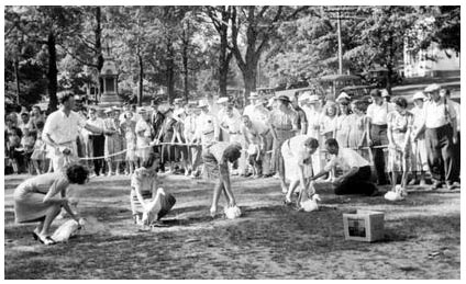
Before the Revolutionary War, Hardwick was enjoying great prosperity. The representative to the General Court, General Timothy Ruggles, had great influence and introduced the market fair in 1762. The outgrowth of this endeavor, the Hardwick Community Fair, continues to this day as a social highlight and carries on the tradition of education and competition for home and farm products.
Saw and grist mills were among the first forms of manufacturing, taking advantage of the many streams as sources of power. The availability of the railroads in the 1800's made shipment of agricultural products and manufactured goods to larger cities an important part of the local economy. Old Furnace had been significant in the days of the Revolution as a manufacturer of cannon balls and continued in importance as a railroad depot.
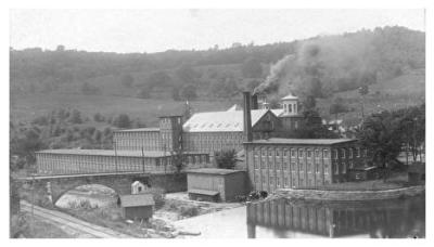
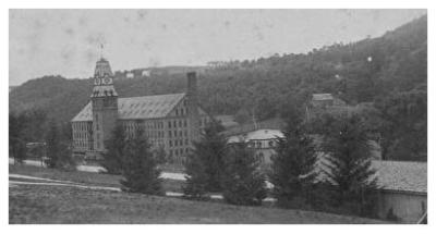
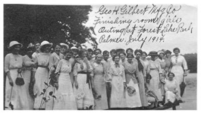
In 1860, George H. Gilbert began purchasing land in the "Hardwick Gore" to expand his Ware wool factories. Eventually his mills, tenements and other buildings became the village of Gilbertville. Gilbert provided a Congregational Church and library for his work force, and contributed to the building of the high school. St. Aloysius Church also served the growing number of immigrants who came to work in the mills. Competition from other regions caused a slowdown in the wool industry and by the 1930's, the Gilbert Manufacturing Company was no longer a viable business. The flood of 1938 destroyed much of the village.
By 1866, a paper mill had been constructed that eventually would be owned by the Wheelwright family. The proprietors encouraged home ownership and created the village as a mixture of housing types. Stores, St. Augustine Church and a village school were all included. In the 1930's, the paper company was sold to new owners, who began manufacturing tissue products.
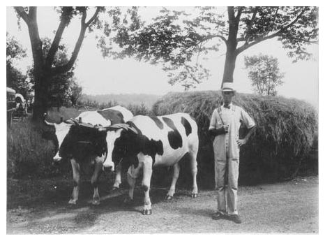
The village of Hardwick retained its agricultural roots. The world-famous Mixter Farm and later Guernsey Dell took advantage of the town's soil conditions to encourage dairy farming. Milk and dairy products were a large part of the economy for many years with creameries and butter and cheese factories located here.
The creation of the Quabbin Reservoir in the 1930's took a portion of the western part of the town but created a new recreation area. The consolidation of the various school districts into village schools was taken a step further with the town's entry into the Quabbin Regional School District in 1967. The school buildings in the villages were converted to other purposes when the new elementary school was built in 1989.